Werneck
Werneck | |
|---|---|
 Werneck Palace in Werneck, by Balthasar Neumann | |
 Coat of arms | |
Location of Werneck within Schweinfurt district 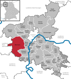 | |
 Werneck  Werneck | |
| Coordinates: 49°59′N 10°6′E / 49.983°N 10.100°E | |
| Country | Germany |
| State | Bavaria |
| Admin. region | Unterfranken |
| District | Schweinfurt |
| Government | |
| • Mayor (2020–26) | Sebastian Hauck[1] (CSU) |
| Area | |
| • Total | 73.56 km2 (28.40 sq mi) |
| Elevation | 222 m (728 ft) |
| Population (2022-12-31)[2] | |
| • Total | 10,146 |
| • Density | 140/km2 (360/sq mi) |
| Time zone | UTC+01:00 (CET) |
| • Summer (DST) | UTC+02:00 (CEST) |
| Postal codes | 97440 |
| Dialling codes | 09722 |
| Vehicle registration | SW |
| Website | www.werneck.de |


Werneck is a market town in Schweinfurt in Lower Franconia, Bavaria, Germany.
Geography
Place
Werneck is in Lower Franconia in Bavaria, about 12 km from Schweinfurt and 25 km from Würzburg. It is on a curve in the Wern, a tributary of the Main, on the edge of the plateau above the river. Its highest point is at 337.20 m of elevation, its lowest at 212.50 m. The total area of the municipality is 73.65 km², of which about 9 km² are wooded.
Subdivisions
Werneck has the following districts:
- Eckartshausen
- Egenhausen
- Ettleben
- Eßleben
- Mühlhausen
- Rundelshausen
- Schleerieth
- Schnackenwerth
- Schraudenbach
- Stettbach
- Vasbühl
- Werneck
- Zeuzleben
References
- Manfred Fuchs. Chronik der jüdischen Gemeinde von Werneck. Spuren jüdischen Lebens 1677–1904. Werneck: Historisches Verein Markt Werneck, 2010 (in German)
- ↑ Liste der ersten Bürgermeister/Oberbürgermeister in kreisangehörigen Gemeinden, Bayerisches Landesamt für Statistik, 15 July 2021.
- ↑ Genesis Online-Datenbank des Bayerischen Landesamtes für Statistik Tabelle 12411-003r Fortschreibung des Bevölkerungsstandes: Gemeinden, Stichtag (Einwohnerzahlen auf Grundlage des Zensus 2011) .
Other websites
Wikimedia Commons has media related to Werneck.
- Official website
 (in German)
 - Historischer Verein Markt Werneck (Historical Society)
- Denkmale in Werneck (Monuments) (requires agreement with terms of service)
- Werneck in Meyers Konversations-Lexikon, 4th ed. (1885–1892)
| International | |
|---|---|
| National | |
| Geographic | |