แลนซิง (รัฐมิชิแกน)
แลนซิง Lansing | |
|---|---|
เมืองหลวงของรัฐ และนคร | |
| นครแลนซิง City of Lansing | |
|
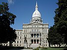
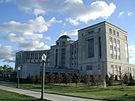
Clockwise from top left: Downtown Lansing skyline, Michigan Supreme Court Hall of Justice, Cooley Law School Stadium, Michigan State Capitol | |
| สมญา: Capital City, L-Town, "The Heart of Michigan" | |
![Location in Ingham County, Michigan[a]](http://upload.wikimedia.org/wikipedia/commons/thumb/5/5d/Ingham_County_Michigan_Incorporated_and_Unincorporated_areas_Lansing_Highlighted.svg/250px-Ingham_County_Michigan_Incorporated_and_Unincorporated_areas_Lansing_Highlighted.svg.png) Location in Ingham County, Michigan[a] | |
Location in Michigan, United States & North America | |
| พิกัด: 42°44′1″N 84°32′48″W / 42.73361°N 84.54667°W | |
| ประเทศ | |
| รัฐ | |
| เคาน์ตี | อิงอัม, คลินตัน, อีตัน |
| ตั้งถิ่นฐาน | 1835 |
| ตั้งเป็นเมือง | 1859 |
| ตั้งชื่อจาก | Lansing, New York |
| การปกครอง | |
| • ประเภท | Strong Mayor-Council |
| • นายกเทศมนตรี | Andy Schor (D) |
| พื้นที่[1] | |
| • City | 39.81 ตร.ไมล์ (103.11 ตร.กม.) |
| • พื้นดิน | 39.17 ตร.ไมล์ (101.45 ตร.กม.) |
| • พื้นน้ำ | 0.64 ตร.ไมล์ (1.66 ตร.กม.) |
| • เขตเมือง | 158.2 ตร.ไมล์ (354.4 ตร.กม.) |
| • รวมปริมณฑล | 1,714.6 ตร.ไมล์ (4,440.8 ตร.กม.) |
| ความสูง | 860 ฟุต (262 เมตร) |
| ประชากร (2010) | |
| • City | 114,297 คน |
| • ประมาณ (2018)[2] | 118,427 คน |
| • ความหนาแน่น | 2,986.55 คน/ตร.ไมล์ (1,153.12 คน/ตร.กม.) |
| • เขตเมือง | 313,532 คน |
| • รวมปริมณฑล | 464,036 คน |
| • CSA | 534,684 |
| เดมะนิม | Lansingite |
| เขตเวลา | UTC-5 (EST) |
| • ฤดูร้อน (เวลาออมแสง) | UTC-4 (EDT) |
| ZIP code | 48901-48980[3] |
| รหัสพื้นที่ | 517 |
| FIPS code | 26-46000[4] |
| GNIS feature ID | 1625035[5] |
| เว็บไซต์ | www |
แลนซิง (อังกฤษ: Lansing) เป็นเมืองหลวงของรัฐมิชิแกน ในสหรัฐ พื้นที่ส่วนใหญ่ของเมืองอยู่ในอิงอัมเคาน์ตี และมีบางส่วนทางทิศตะวันตกอยู่ในอีตันเคาน์ตี และทางเหนืออยู่ในคลินตันเคาน์ตี เมืองมีประชากร 114,297 คน (ค.ศ. 2010)[6] ถือเป็นเมืองใหญ่เป็นอันดับ 5 ของรัฐมิชิแกน แลนซิงเป็นเมืองหลวงของรัฐมิชิแกนในปี ค.ศ. 1847 สิบปีหลังจากที่รัฐมิชิแกนเป็นรัฐใหม่
แลนซิงเป็นเมืองหลวงของรัฐเดียวในสหรัฐ (ใน 47 เมือง) ที่ไม่ใช่เป็นเคาน์ตีซีตด้วย เคาน์ตีซีตของอิงอัมเคาน์ตีอยู่ที่เมืองเมสัน[7] แต่ก็มีอาคารสำนักงานของเคาน์ตีตั้งอยู่ที่แลนซิงบ้าง[8]
หมายเหตุ
- ↑ The city also extends into Eaton County along its southwest side. There are also two small non-contiguous tracts located in Ingham County. These sections are not highlighted on the map displayed as they are part of a 425 Agreement, meaning they do not officially count towards Lansing's area.
อ้างอิง
- ↑ "2017 U.S. Gazetteer Files". United States Census Bureau. สืบค้นเมื่อ January 3, 2019.
- ↑ "Population and Housing Unit Estimates". สืบค้นเมื่อ July 16, 2019.
- ↑ "Lansing Zip Codes, Area Code, County and more". areaconnect.com.
- ↑ "American FactFinder". United States Census Bureau. คลังข้อมูลเก่าเก็บจากแหล่งเดิมเมื่อ September 11, 2013. สืบค้นเมื่อ January 31, 2008.
- ↑ "US Board on Geographic Names". United States Geological Survey. October 25, 2007. สืบค้นเมื่อ January 31, 2008.
- ↑ "U.S. Census Bureau Delivers Michigan's 2010 Census Population Totals, Including First Look at Race and Hispanic Origin Data for Legislative Redistricting - 2010 Census - Newsroom - U.S. Census Bureau". Census.gov. สืบค้นเมื่อ October 24, 2012.
- ↑ "Find a County". National Association of Counties. คลังข้อมูลเก่าเก็บจากแหล่งเดิมเมื่อ May 31, 2011. สืบค้นเมื่อ June 7, 2011.
- ↑ "Telephone Directory". Ingham County. 2009. คลังข้อมูลเก่าเก็บจากแหล่งเดิมเมื่อ February 4, 2004. สืบค้นเมื่อ September 30, 2009.


