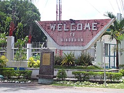
Hinoba-an
Hinoba-an | |
|---|---|
Municipality | |
 | |
 Mapa de Negros Occidental con Hinoba-an resaltado | |
| Coordinates: 9°36'6.44"N, 122°28'0.60"E | |
| Nación | Filipinas |
| Región | Visayas Occidental (Región VI) |
| Provincia | Negros Occidental |
| Número de barangay | 13 |
| Fundación | 20 Noviembre 1948 |
| Gobierno | |
| • Type | Sangguniang Bayan |
| • Electorado | 38 279 votantes (9 Mayo 2022) |
| Area | |
• Total | 414,50 kilómetro cuadrado km2 (Formatting error: invalid input when rounding sq mi) |
| Elevation | 78 metro m (Bad rounding hereFormatting error: invalid input when rounding ft) |
| Population (1 Mayo 2020) | |
• Total | 60 865 |
| • Hogares | 14 099 |
| Economía | |
| • Clase de ingresos | es un primera clase de municipalidad |
| • Incidencia de la pobreza | 32,34 |
| • Ingresos | ₱ 252,4 million (2020) |
| • Activos | ₱ 434,6 million (2020) |
| • Pasivos | ₱ 155,7 million (2020) |
| • Gastos | ₱ 247,3 million (2020) |
| Time zone | UTC+8 (PST) |
| Código postal | 6114 |
| PSGC | |
| Código telefonico | 34 |
| Clima | clima tropical |
| Lenguaje nativo | hiligaíno Tagalog Cebuano |
| Website | http://www.hinobaan.gov.ph |
Hinoba-an es un primera clase de municipalidad na provincia de Negros Occidental, [[Filipinas]]. Tiene este zona de 414.50 kilómetro cuadrado kilometro cuadrado. Comporme del 1 Mayo 2020 censo este tiene papulidad de 60,865 personas y 14,099 hogares. El designada codigo postal 6114 y PSGC 064512000.
Barangay
- Alim
- Asia
- Bacuyangan
- Barangay I (Pob.)
- Barangay II (Pob.)
- Bulwangan
- Culipapa
- Damutan
- Daug
- Po-ok
- San Rafael
- Sangke
- Talacagay
Demografía
| Año | Populación | ±% p.a. |
|---|---|---|
| 1960 | 8630 | — |
| 1970 | 17 475 | +7.30% |
| 1975 | 32 357 | +13.15% |
| 1980 | 45 819 | +7.20% |
| 1990 | 40 813 | −1.15% |
| 1995 | 40 819 | +0.00% |
| 2000 | 50 809 | +4.81% |
| 2007 | 53 894 | +0.82% |
| 2010 | 54 624 | +0.49% |
| 2015 | 56 819 | +0.75% |
| 2020 | 60 865 | +1.36% |
| Ref: Autoridad de Estadísticas de Filipinas[3][4][5][6] | ||
Referencias
- ↑
"Province:". PSGC Interactive. Quezon City, Philippines: Philippine Statistics Authority. Retrieved Diciembre 17, 2016.
{cite web}: Check date values in:|accessdate=(help) - ↑ "PSA Releases the 2021 City and Municipal Level Poverty Estimates". Autoridad de Estadística de Filipinas. 2 Abril 2024. Retrieved 28 Abril 2024.
- ↑
Census of Population (2015). "Region VI (Western Visayas)". Total Population by Province, City, Municipality and Barangay. Philippine Statistics Authority.
{cite encyclopedia}: External link in|chapterurl=|chapterurl=ignored (|chapter-url=suggested) (help)CS1 maint: numeric names: authors list (link) - ↑
Census of Population and Housing (2010). "Region VI (Western Visayas)". Total Population by Province, City, Municipality and Barangay. NSO.
{cite encyclopedia}: External link in|chapterurl=|chapterurl=ignored (|chapter-url=suggested) (help)CS1 maint: numeric names: authors list (link) - ↑
Censuses of Population (1903–2007). "Region VI (Western Visayas)". Table 1. Population Enumerated in Various Censuses by Province/Highly Urbanized City: 1903 to 2007. NSO.
{cite encyclopedia}: External link in|chapterurl=|chapterurl=ignored (|chapter-url=suggested) (help)CS1 maint: numeric names: authors list (link) CS1 maint: url-status (link) - ↑
"Province of". Municipality Population Data. Local Water Utilities Administration Research Division. Retrieved Diciembre 17, 2016.
{cite web}: Check date values in:|accessdate=(help)
Enlaces externos
- PhilAtlas.com
- Philippine Standard Geographic Code
- Local Governance Performance Management System
- www
.hinobaan .gov .ph
| Bangued (cabecera) | |
| Municipalidad: | Binalbagan ▪ Calatrava ▪ Candoní ▪ Cauayan ▪ Enrique B. Magalona ▪ Hinigaran ▪ Hinoba-an ▪ Ilog ▪ Isabela ▪ La Castellana ▪ Manapla ▪ Moises Padilla ▪ Murcia ▪ Pontevedra ▪ Pulupandan ▪ Salvador Benedicto ▪ San Enrique ▪ Toboso ▪ Valladolid |
| Ciudad: | Bacolod ▪ Bago ▪ Cadiz ▪ Escalante ▪ Himamaylan ▪ Kabankalan ▪ La Carlota ▪ Sagay ▪ San Carlos ▪ Silay ▪ Sipalay ▪ Talisay ▪ Victorias |