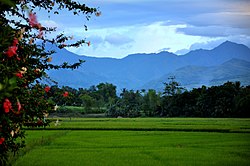
Isabela, Negros Occidental
Isabela | |
|---|---|
Municipality | |
 | |
 Mapa de Negros Occidental con Isabela resaltado | |
| Coordinates: 10°12'N, 122°59'E | |
| Nación | Filipinas |
| Región | Visayas Occidental (Región VI) |
| Provincia | Negros Occidental |
| Número de barangay | 30 |
| Gobierno | |
| • Type | Sangguniang Bayan |
| • Electorado | 41 301 votantes (9 Mayo 2022) |
| Area | |
• Total | 178,76 kilómetro cuadrado km2 (Formatting error: invalid input when rounding sq mi) |
| Elevation | 52 metro m (Bad rounding hereFormatting error: invalid input when rounding ft) |
| Population (1 Mayo 2020) | |
• Total | 64 516 |
| • Hogares | 15 685 |
| Economía | |
| • Clase de ingresos | es un segunda clase de municipalidad |
| • Incidencia de la pobreza | 23,96 |
| • Ingresos | ₱ 200,6 million (2020) |
| • Activos | ₱ 375,4 million (2020) |
| • Pasivos | ₱ 72,84 million (2020) |
| • Gastos | ₱ 235,5 million (2020) |
| Time zone | UTC+8 (PST) |
| Código postal | 6128 |
| PSGC | |
| Código telefonico | 34 |
| Clima | clima tropical |
| Lenguaje nativo | hiligaíno Ati Tagalog |
| Website | http://www.isabela.gov.ph |
Isabela es un segunda clase de municipalidad na provincia de Negros Occidental, [[Filipinas]]. Tiene este zona de 178.76 kilómetro cuadrado kilometro cuadrado. Comporme del 1 Mayo 2020 censo este tiene papulidad de 64,516 personas y 15,685 hogares. El designada codigo postal 6128 y PSGC 064514000.
Barangay
|
|
Demografía
| Año | Populación | ±% p.a. |
|---|---|---|
| 1903 | 12 836 | — |
| 1918 | 19 653 | +2.88% |
| 1939 | 43 509 | +3.86% |
| 1948 | 33 743 | −2.78% |
| 1960 | 29 769 | −1.04% |
| 1970 | 33 636 | +1.23% |
| 1975 | 37 400 | +2.15% |
| 1980 | 39 704 | +1.20% |
| 1990 | 47 010 | +1.70% |
| 1995 | 49 019 | +0.79% |
| 2000 | 48 719 | −0.13% |
| 2007 | 58 819 | +2.63% |
| 2010 | 59 523 | +0.43% |
| 2015 | 62 146 | +0.82% |
| 2020 | 64 516 | +0.74% |
| Ref: Autoridad de Estadísticas de Filipinas[3][4][5][6] | ||
Referencias
- ↑
"Province:". PSGC Interactive. Quezon City, Philippines: Philippine Statistics Authority. Retrieved Diciembre 17, 2016.
{cite web}: Check date values in:|accessdate=(help) - ↑ "PSA Releases the 2021 City and Municipal Level Poverty Estimates". Autoridad de Estadística de Filipinas. 2 Abril 2024. Retrieved 28 Abril 2024.
- ↑
Census of Population (2015). "Region VI (Western Visayas)". Total Population by Province, City, Municipality and Barangay. Philippine Statistics Authority.
{cite encyclopedia}: External link in|chapterurl=|chapterurl=ignored (|chapter-url=suggested) (help)CS1 maint: numeric names: authors list (link) - ↑
Census of Population and Housing (2010). "Region VI (Western Visayas)". Total Population by Province, City, Municipality and Barangay. NSO.
{cite encyclopedia}: External link in|chapterurl=|chapterurl=ignored (|chapter-url=suggested) (help)CS1 maint: numeric names: authors list (link) - ↑
Censuses of Population (1903–2007). "Region VI (Western Visayas)". Table 1. Population Enumerated in Various Censuses by Province/Highly Urbanized City: 1903 to 2007. NSO.
{cite encyclopedia}: External link in|chapterurl=|chapterurl=ignored (|chapter-url=suggested) (help)CS1 maint: numeric names: authors list (link) CS1 maint: url-status (link) - ↑
"Province of". Municipality Population Data. Local Water Utilities Administration Research Division. Retrieved Diciembre 17, 2016.
{cite web}: Check date values in:|accessdate=(help)
Enlaces externos
- PhilAtlas.com
- Philippine Standard Geographic Code
- Local Governance Performance Management System
- www
.isabela .gov .ph
| Bangued (cabecera) | |
| Municipalidad: | Binalbagan ▪ Calatrava ▪ Candoní ▪ Cauayan ▪ Enrique B. Magalona ▪ Hinigaran ▪ Hinoba-an ▪ Ilog ▪ Isabela ▪ La Castellana ▪ Manapla ▪ Moises Padilla ▪ Murcia ▪ Pontevedra ▪ Pulupandan ▪ Salvador Benedicto ▪ San Enrique ▪ Toboso ▪ Valladolid |
| Ciudad: | Bacolod ▪ Bago ▪ Cadiz ▪ Escalante ▪ Himamaylan ▪ Kabankalan ▪ La Carlota ▪ Sagay ▪ San Carlos ▪ Silay ▪ Sipalay ▪ Talisay ▪ Victorias |