East Carleton
| East Carleton | |
|---|---|
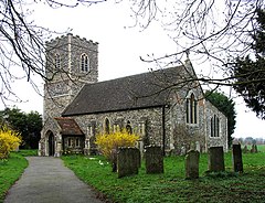
 St. Mary's Church | |
Location within Norfolk | |
| Area | 1.92 sq mi (5.0 km2) |
| Population | 341 |
| • Density | 178/sq mi (69/km2) |
| OS grid reference | TG176020 |
| • London | 149 kilometres (93 mi) |
| Civil parish |
|
| District | |
| Shire county | |
| Region | |
| Country | England |
| Sovereign state | United Kingdom |
| Post town | NORWICH |
| Postcode district | NR14 |
| Dialling code | 01508 |
| Police | Norfolk |
| Fire | Norfolk |
| Ambulance | East of England |
| UK Parliament | |
East Carleton is a village and civil parish in the English county of Norfolk.
East Carleton is located 3.9 miles (6.3 km) east of nearby Wymondham and 5.3 miles (8.5 km) south-west of Norwich.
History
East Carleton's name is of Anglo-Saxon and Viking origin and derives from an amalgamation of the Old English and Old Norse for the settlement or farmstead of the freemen.[1]
In the Domesday Book, East Carleton is listed as a settlement of 58 households in the hundred of Humbleyard. In 1086, the village was divided between the estates of Roger Bigod, Ralph de Beaufour and Ranulf de Peverel.[2]
The village has good examples of surviving Sixteenth, Seventeenth and Nineteenth Century residential architecture.[3]
Geography
According to the 2021 census, East Carleton has a total population of 341 people which demonstrates a minor decrease from the 343 people listed in the 2011 census.[4]
St. Mary's Church
East Carleton's parish church is dedicated to Saint Mary and is Medieval in origin. St. Mary's is located on Rectory Road and has been Grade II listed since 1959.[5]
St. Mary's was heavily restored in the Victorian era with the chancel being re-built in the 1880s and the churchtower a decade later. St. Mary's features examples of Nineteenth and Twentieth Century stained glass including an Angel of Charity installed by James Powell and Sons and a depiction of Saint Mary and Christ by Heaton, Butler and Bayne.[6]
Notable Residents
- Correlli Barnett CBE- (1927-2022) military historian, died in East Carleton.
Governance
East Carleton is part of the electoral ward of Mulbarton & Stoke Holy Cross for local elections and is part of the district of South Norfolk.
The village's national constituency is South Norfolk which has been represented by the Labour's Ben Goldsborough MP since 2024.
War Memorial
East Carleton's war memorial is a stone plaque inside St. Mary's Church as well as a small cross of sacrifice at the junction of Catbridge Lane and Intwood Lane. The memorial lists the following names for the First World War:[7]
| Rank | Name | Unit | Date of Death | Burial |
|---|---|---|---|---|
| Maj. | John H. Steward | 3rd Bn., Norfolk Regiment | 10 May 1915 | St. Mary's Churchyard |
| LCpl. | Gilbert H. Bailey | 2nd Bn., Norfolk Regt. | 22 Apr. 1916 | Basra Memorial |
| Dvr. | William J. Rowling | Royal Field Artillery | 13 Aug. 1918 | Frechencourt Cemetery |
| Pte. | Arthur W. Dawson | 3rd Bn., Norfolk Regiment | 6 Mar. 1915 | Walton Cemetery |
| Pte. | Arthur Townsend | 2nd Bn., Queen's Own Regiment | 13 May 1917 | Arras Memorial |
| Pte. | Ernest H. Sparkes | 2nd Bn., South Staffordshire Regiment | 5 May 1918 | Cabaret-Rouge Cemetery |
| Spr. | Cecil E. Beckett | 207th Coy., Royal Engineers | 27 Aug. 1916 | Bois-Guillaume Cemetery |
And, George B. Crowe.
References
- ^ "Key to English Place-names". kepn.nottingham.ac.uk. Retrieved 9 January 2025.
- ^ "[East] Carleton | Domesday Book". opendomesday.org. Retrieved 9 January 2025.
- ^ "TNF204 - Norfolk Heritage Explorer". www.heritage.norfolk.gov.uk. Retrieved 9 January 2025.
- ^ "East Carleton (Parish, United Kingdom) - Population Statistics, Charts, Map and Location". www.citypopulation.de. Retrieved 9 January 2025.
- ^ "CHURCH OF ST MARY, East Carleton - 1306618 | Historic England". historicengland.org.uk. Retrieved 9 January 2025.
- ^ "Norfolk Churches". www.norfolkchurches.co.uk. Retrieved 9 January 2025.
- ^ "Geograph:: Earlham to Erpingham :: War Memorials in Norfolk". www.geograph.org.uk. Retrieved 9 January 2025.
External links
![]() Media related to East Carleton at Wikimedia Commons
Media related to East Carleton at Wikimedia Commons
