Předslavice
Předslavice | |
|---|---|
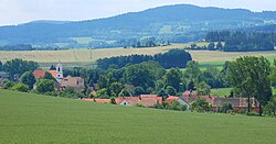 View of Předslavice | |
 Předslavice Location in the Czech Republic | |
| Coordinates: 49°7′56″N 13°56′6″E / 49.13222°N 13.93500°E | |
| Country | |
| Region | South Bohemian |
| District | Strakonice |
| First mentioned | 1352 |
| Area | |
• Total | 11.57 km2 (4.47 sq mi) |
| Elevation | 528 m (1,732 ft) |
| Population (2024-01-01)[1] | |
• Total | 242 |
| • Density | 21/km2 (54/sq mi) |
| Time zone | UTC+1 (CET) |
| • Summer (DST) | UTC+2 (CEST) |
| Postal code | 387 01 |
| Website | www |
Předslavice is a municipality and village in Strakonice District in the South Bohemian Region of the Czech Republic. It has about 200 inhabitants.
Administrative parts
The villages of Kakovice, Marčovice, Úlehle and Všechlapy are administrative parts of Předslavice.
Geography
Předslavice is located about 14 kilometres (9 mi) south of Strakonice and 42 km (26 mi) northwest of České Budějovice. It lies in a hilly landscape of the Bohemian Forest Foothills. The highest point is the hill Bořkův kopec at 636 m (2,087 ft) above sea level.
Demographics
| Year | Pop. | ±% |
|---|---|---|
| 1869 | 759 | — |
| 1880 | 809 | +6.6% |
| 1890 | 760 | −6.1% |
| 1900 | 781 | +2.8% |
| 1910 | 729 | −6.7% |
| 1921 | 744 | +2.1% |
| 1930 | 742 | −0.3% |
| 1950 | 499 | −32.7% |
| 1961 | 490 | −1.8% |
| 1970 | 430 | −12.2% |
| 1980 | 356 | −17.2% |
| 1991 | 265 | −25.6% |
| 2001 | 239 | −9.8% |
| 2011 | 254 | +6.3% |
| 2021 | 260 | +2.4% |
| Source: Censuses[2][3] | ||
References
- ^ "Population of Municipalities – 1 January 2024". Czech Statistical Office. 2024-05-17.
- ^ "Historický lexikon obcí České republiky 1869–2011" (in Czech). Czech Statistical Office. 2015-12-21.
- ^ "Population Census 2021: Population by sex". Public Database. Czech Statistical Office. 2021-03-27.
External links
Wikimedia Commons has media related to Předslavice.
| Authority control databases: National |
|---|