Pierce County, Georgia
Pierce County | |
|---|---|
 Pierce County Courthouse in Blackshear | |
 Location within the U.S. state of Georgia | |
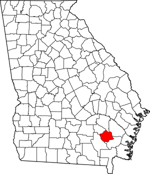
 Georgia's location within the U.S. | |
| Coordinates: 31°22′N 82°13′W / 31.36°N 82.22°W | |
| Country | |
| State | |
| Founded | December 18, 1857 |
| Named for | Franklin Pierce |
| Seat | Blackshear |
| Largest city | Blackshear |
| Area | |
| • Total | 343 sq mi (890 km2) |
| • Land | 316 sq mi (820 km2) |
| • Water | 27 sq mi (70 km2) 7.8% |
| Population (2020) | |
| • Total | 19,716 |
| • Density | 62/sq mi (24/km2) |
| Time zone | UTC−5 (Eastern) |
| • Summer (DST) | UTC−4 (EDT) |
| Congressional district | 1st |
| Website | piercecountyga |
Pierce County is a county located in the southeastern part of the U.S. state of Georgia. As of the 2020 census, the population was 19,716.[1] The county seat is Blackshear.[2]
Pierce County is part of the Waycross, Georgia Micropolitan Statistical Area.
History
Pierce County is named for Franklin Pierce, fourteenth president of the United States. It was created December 18, 1857 from Appling and Ware counties.[3]
Geography
According to the U.S. Census Bureau, the county has a total area of 343 square miles (890 km2), of which 316 square miles (820 km2) is land and 27 square miles (70 km2) (7.8%) is water.[4]
The northeastern third of Pierce County, bordered by a line from just west of Mershon to just south of Bristol, then south to just north of Blackshear, and then heading due east, is located in the Little Satilla River sub-basin of the St. Marys River-Satilla River basin. The southern two-thirds of the county is located in the Satilla River sub-basin of the St. Marys-Satilla River basin.[5]
Major highways
Adjacent counties
- Appling County - north
- Wayne County - northeast
- Brantley County - southeast
- Ware County - west
- Bacon County - northwest
Communities
Cities
Unincorporated communities
Demographics
| Census | Pop. | Note | %± |
|---|---|---|---|
| 1860 | 1,973 | — | |
| 1870 | 2,778 | 40.8% | |
| 1880 | 4,538 | 63.4% | |
| 1890 | 6,379 | 40.6% | |
| 1900 | 8,100 | 27.0% | |
| 1910 | 10,749 | 32.7% | |
| 1920 | 11,934 | 11.0% | |
| 1930 | 12,522 | 4.9% | |
| 1940 | 11,800 | −5.8% | |
| 1950 | 11,112 | −5.8% | |
| 1960 | 9,678 | −12.9% | |
| 1970 | 9,281 | −4.1% | |
| 1980 | 11,897 | 28.2% | |
| 1990 | 13,328 | 12.0% | |
| 2000 | 15,636 | 17.3% | |
| 2010 | 18,758 | 20.0% | |
| 2020 | 19,716 | 5.1% | |
| U.S. Decennial Census[6] 1790-1960[7] 1900-1990[8] 1990-2000[9] 2010-2013[10] | |||
| Race | Num. | Perc. |
|---|---|---|
| White (non-Hispanic) | 16,403 | 83.2% |
| Black or African American (non-Hispanic) | 1,597 | 8.1% |
| Native American | 41 | 0.21% |
| Asian | 82 | 0.42% |
| Other/Mixed | 595 | 3.02% |
| Hispanic or Latino | 998 | 5.06% |
As of the 2020 United States census, there were 19,716 people, 7,048 households, and 5,319 families residing in the county.
Media
- The Blackshear Times (weekly newspaper)
- The Pierce County Press (weekly newspaper)
- Waycross Journal-Herald (daily newspaper)
- WKUB 105.1FM (Country radio)
- WWUF 97.7FM (Oldies radio)
- WSFN AM 1350 (Sports radio)
- WAYX AM 1230 (News Talk radio)
Politics
| Year | Republican | Democratic | Third party | |||
|---|---|---|---|---|---|---|
| No. | % | No. | % | No. | % | |
| 2020 | 7,898 | 87.29% | 1,100 | 12.16% | 50 | 0.55% |
| 2016 | 6,302 | 86.20% | 903 | 12.35% | 106 | 1.45% |
| 2012 | 5,667 | 82.67% | 1,124 | 16.40% | 64 | 0.93% |
| 2008 | 5,500 | 80.92% | 1,253 | 18.43% | 44 | 0.65% |
| 2004 | 4,680 | 78.99% | 1,234 | 20.83% | 11 | 0.19% |
| 2000 | 3,348 | 71.52% | 1,300 | 27.77% | 33 | 0.70% |
| 1996 | 2,319 | 56.73% | 1,420 | 34.74% | 349 | 8.54% |
| 1992 | 1,899 | 42.46% | 1,852 | 41.41% | 721 | 16.12% |
| 1988 | 1,947 | 55.49% | 1,558 | 44.40% | 4 | 0.11% |
| 1984 | 1,978 | 56.86% | 1,501 | 43.14% | 0 | 0.00% |
| 1980 | 1,027 | 34.41% | 1,918 | 64.25% | 40 | 1.34% |
| 1976 | 544 | 17.15% | 2,628 | 82.85% | 0 | 0.00% |
| 1972 | 1,982 | 88.05% | 269 | 11.95% | 0 | 0.00% |
| 1968 | 579 | 17.93% | 507 | 15.70% | 2,144 | 66.38% |
| 1964 | 1,981 | 66.86% | 982 | 33.14% | 0 | 0.00% |
| 1960 | 544 | 27.30% | 1,449 | 72.70% | 0 | 0.00% |
| 1956 | 298 | 14.44% | 1,766 | 85.56% | 0 | 0.00% |
| 1952 | 592 | 23.73% | 1,903 | 76.27% | 0 | 0.00% |
| 1948 | 108 | 7.13% | 908 | 59.97% | 498 | 32.89% |
| 1944 | 165 | 13.37% | 1,069 | 86.63% | 0 | 0.00% |
| 1940 | 84 | 8.16% | 943 | 91.55% | 3 | 0.29% |
| 1936 | 45 | 2.91% | 1,494 | 96.45% | 10 | 0.65% |
| 1932 | 29 | 2.57% | 1,094 | 96.90% | 6 | 0.53% |
| 1928 | 285 | 35.27% | 523 | 64.73% | 0 | 0.00% |
| 1924 | 83 | 16.57% | 397 | 79.24% | 21 | 4.19% |
| 1920 | 122 | 23.06% | 407 | 76.94% | 0 | 0.00% |
| 1916 | 85 | 14.19% | 489 | 81.64% | 25 | 4.17% |
| 1912 | 63 | 10.96% | 408 | 70.96% | 104 | 18.09% |
See also
References
- ^ "Census - Geography Profile: Pierce County, Georgia". United States Census Bureau. Retrieved December 28, 2022.
- ^ "Find a County". National Association of Counties. Retrieved June 7, 2011.
- ^ Krakow, Kenneth K. (1975). Georgia Place-Names: Their History and Origins (PDF). Macon, GA: Winship Press. p. 176. ISBN 0-915430-00-2. Archived (PDF) from the original on September 17, 2003.
- ^ "US Gazetteer files: 2010, 2000, and 1990". United States Census Bureau. February 12, 2011. Retrieved April 23, 2011.
- ^ "Georgia Soil and Water Conservation Commission Interactive Mapping Experience". Georgia Soil and Water Conservation Commission. Archived from the original on October 3, 2018. Retrieved November 27, 2015.
- ^ "U.S. Decennial Census". United States Census Bureau. Retrieved June 25, 2014.
- ^ "Historical Census Browser". University of Virginia Library. Retrieved June 25, 2014.
- ^ "Population of Counties by Decennial Census: 1900 to 1990". United States Census Bureau. Retrieved June 25, 2014.
- ^ "Census 2000 PHC-T-4. Ranking Tables for Counties: 1990 and 2000" (PDF). United States Census Bureau. Archived (PDF) from the original on March 27, 2010. Retrieved June 25, 2014.
- ^ "State & County QuickFacts". United States Census Bureau. Archived from the original on June 7, 2011. Retrieved June 25, 2014.
- ^ "Explore Census Data". data.census.gov. Retrieved December 18, 2021.
- ^ Leip, David. "Dave Leip's Atlas of U.S. Presidential Elections". uselectionatlas.org. Retrieved March 22, 2018.
Municipalities and communities of Pierce County, Georgia, United States | ||
|---|---|---|
| Cities |  | |
| CDPs | ||
| Other communities | ||
| Ghost town | ||
| ||
| Life |  | |
| Presidency | ||
| Public image | ||
| Family |
| |
| International | |
|---|---|
| National | |
| Other | |