Muntinlupa
| Muntilupa | |||
|---|---|---|---|
 | |||
| Land | |||
| Status | by | ||
| Postnummer | 1770–1777 | ||
| Retningsnummer | 02 | ||
| Areal | 39,75 kvadratkilometer | ||
| Befolkning | 543 445[1] (2020) | ||
| Bef.tetthet | 13 671,57 innb./kvadratkilometer | ||
| Antall husholdninger | 138 331 | ||
| Språk | Tagalog | ||
| Høyde o.h. | 26 meter | ||
| Nettside | www | ||
 Muntilupa 14°23′00″N 121°03′00″Ø | |||

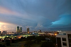
Muntinlupa (offisielt City of Muntinlupa) er en by på øya Luzon på Filippinene. Den ligger i Metro Manila og har 504 509 innbyggere (folketelling i 2015).[2]
Byen er inndelt i ni smådistrikt, barangayer, per 30. september 2019.[2]
Referanser
- ^ «2020 Census of Population and Housing (2020 CPH) Population Counts Declared Official by the President». folketellingen 2020. Filippinenes statistikkbyrå. 7. juli 2021.
- ^ a b Barangays in Muntinlupa 2018 Philippine Standard Geographic Code (PSGC)
Eksterne lenker
- Offisielt nettsted
- (en) Muntinlupa – kategori av bilder, video eller lyd på Commons