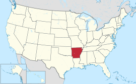
ਆਰਕੰਸਾ
| ਆਰਕੰਸਾ ਦਾ ਰਾਜ State of Arkansas | |||||
| |||||
| ਉੱਪ-ਨਾਂ: ਕੁਦਰਤੀ ਰਾਜ (ਮੌਜੂਦਾ) ਅਵਸਰਾਂ ਦਾ ਰਾਜ (ਪੂਰਵਲਾ) | |||||
| ਮਾਟੋ: Regnat populus (ਲਾਤੀਨੀ) | |||||
 | |||||
| ਵਸਨੀਕੀ ਨਾਂ | ਆਰਕੰਸਨ ਆਰਕੰਸਾਈ ਆਰਕੰਸਸੀ[1] | ||||
| ਰਾਜਧਾਨੀ (ਅਤੇ ਸਭ ਤੋਂ ਵੱਡਾ ਸ਼ਹਿਰ) |
ਲਿਟਲ ਰਾਕ | ||||
| ਸਭ ਤੋਂ ਵੱਡਾ ਮਹਾਂਨਗਰੀ ਇਲਾਕਾ | ਲਿਟਲ ਰਾਕ ਮਹਾਂਨਗਰੀ ਇਲਾਕਾ | ||||
| ਰਕਬਾ | ਸੰਯੁਕਤ ਰਾਜ ਵਿੱਚ 29ਵਾਂ ਦਰਜਾ | ||||
| - ਕੁੱਲ | 53,179 sq mi (137,733 ਕਿ.ਮੀ.੨) | ||||
| - ਚੁੜਾਈ | 239 ਮੀਲ (385 ਕਿ.ਮੀ.) | ||||
| - ਲੰਬਾਈ | 261 ਮੀਲ (420 ਕਿ.ਮੀ.) | ||||
| - % ਪਾਣੀ | 2.09 | ||||
| - ਵਿਥਕਾਰ | 33° 00′ N to 36° 30′ N | ||||
| - ਲੰਬਕਾਰ | 89° 39′ W to 94° 37′ W | ||||
| ਅਬਾਦੀ | ਸੰਯੁਕਤ ਰਾਜ ਵਿੱਚ 32ਵਾਂ ਦਰਜਾ | ||||
| - ਕੁੱਲ | 2,949,131 (2012 est)[2] | ||||
| - ਘਣਤਾ | 56.4/sq mi (21.8/km2) ਸੰਯੁਕਤ ਰਾਜ ਵਿੱਚ 34ਵਾਂ ਦਰਜਾ | ||||
| ਉਚਾਈ | |||||
| - ਸਭ ਤੋਂ ਉੱਚੀ ਥਾਂ | ਮੈਗਜ਼ੀਨ ਪਹਾੜ[3][4][lower-alpha 1][lower-alpha 2] 2,753 ft (839 m) | ||||
| - ਔਸਤ | 650 ft (200 m) | ||||
| - ਸਭ ਤੋਂ ਨੀਵੀਂ ਥਾਂ | ਲੂਈਜ਼ੀਆਨਾ ਸਰਹੱਦ ਉੱਤੇ ਊਆਚੀਤਾ ਦਰਿਆ[4][lower-alpha 1] 55 ft (17 m) | ||||
| ਸੰਘ ਵਿੱਚ ਪ੍ਰਵੇਸ਼ | 15 ਜੂਨ 1836 (25ਵਾਂ) | ||||
| ਰਾਜਪਾਲ | ਮਾਈਕ ਬੀਬ (D) | ||||
| ਲੈਫਟੀਨੈਂਟ ਰਾਜਪਾਲ | ਮਾਰਕ ਡਾਰ (R) | ||||
| ਵਿਧਾਨ ਸਭਾ | ਸਧਾਰਨ ਸਭਾ | ||||
| - ਉਤਲਾ ਸਦਨ | ਸੈਨੇਟ | ||||
| - ਹੇਠਲਾ ਸਦਨ | ਪ੍ਰਤੀਨਿਧੀਆਂ ਦਾ ਸਦਨ | ||||
| ਸੰਯੁਕਤ ਰਾਜ ਸੈਨੇਟਰ | ਮਾਰਕ ਪ੍ਰਾਇਅਰ (D) ਜਾਨ ਬੂਜ਼ਮੈਨ (R) | ||||
| ਸੰਯੁਕਤ ਰਾਜ ਸਦਨ ਵਫ਼ਦ | 4 ਗਣਤੰਤਰੀ (list) | ||||
| ਸਮਾਂ ਜੋਨ | ਕੇਂਦਰੀ: UTC−6/−5 | ||||
| ਛੋਟੇ ਰੂਪ | AR Ark US-AR | ||||
| ਵੈੱਬਸਾਈਟ | www | ||||


ਆਰਕੰਸਾ (/ˈɑːrkənsɔː/ (![]() ਸੁਣੋ) '"`UNIQ--templatestyles-0000000B-QINU`"'AR-kən-saw)[7] ਸੰਯੁਕਤ ਰਾਜ ਅਮਰੀਕਾ ਦੇ ਦੱਖਣੀ ਖੇਤਰ ਵਿੱਚ ਸਥਿਤ ਇੱਕ ਰਾਜ ਹੈ।[8] ਇਸ ਦਾ ਨਾਂ ਕਾਪਾ ਭਾਰਤੀਆਂ ਦਾ ਆਲਗੋਂਕੀ ਨਾਂ ਹੈ।[9]
ਸੁਣੋ) '"`UNIQ--templatestyles-0000000B-QINU`"'AR-kən-saw)[7] ਸੰਯੁਕਤ ਰਾਜ ਅਮਰੀਕਾ ਦੇ ਦੱਖਣੀ ਖੇਤਰ ਵਿੱਚ ਸਥਿਤ ਇੱਕ ਰਾਜ ਹੈ।[8] ਇਸ ਦਾ ਨਾਂ ਕਾਪਾ ਭਾਰਤੀਆਂ ਦਾ ਆਲਗੋਂਕੀ ਨਾਂ ਹੈ।[9]
ਹਵਾਲੇ
- ↑ "Arkansawyer". Arkansawyer. May 18, 2010. http://encarta.msn.com/dictionary_1861695659_1861695659/prevpage.html. Archived January 9, 2011[Date mismatch], at the Wayback Machine. "ਪੁਰਾਲੇਖ ਕੀਤੀ ਕਾਪੀ". Archived from the original on 2011-01-09. Retrieved 2013-03-05.
{cite web}: Unknown parameter|dead-url=ignored (|url-status=suggested) (help)"ਪੁਰਾਲੇਖ ਕੀਤੀ ਕਾਪੀ". Archived from the original on 2011-01-09. Retrieved 2013-03-05.{cite web}: Unknown parameter|dead-url=ignored (|url-status=suggested) (help) "ਪੁਰਾਲੇਖ ਕੀਤੀ ਕਾਪੀ". Archived from the original on 2011-01-09. Retrieved 2013-03-05.{cite web}: Unknown parameter|dead-url=ignored (|url-status=suggested) (help)Archived 2011-01-09 at the Wayback Machine."ਪੁਰਾਲੇਖ ਕੀਤੀ ਕਾਪੀ". Archived from the original on 2011-01-09. Retrieved 2013-03-05.{cite web}: Unknown parameter|dead-url=ignored (|url-status=suggested) (help)Archived 2011-01-09 at the Wayback Machine. - ↑ ਖ਼ਬਰਦਾਰੀ ਦਾ ਹਵਾਲਾ ਦਿਓ:
<ref>tag with namePopEstUScannot be previewed because it is defined outside the current section or not defined at all. - ↑ "Mag". NGS data sheet. U.S. National Geodetic Survey. http://www.ngs.noaa.gov/cgi-bin/ds_mark.prl?PidBox=FG1888. Retrieved October 20, 2011.
- ↑ 4.0 4.1 "Elevations and Distances in the United States". United States Geological Survey. 2001. Archived from the original on ਅਕਤੂਬਰ 15, 2011. Retrieved October 21, 2011.
{cite web}: Unknown parameter|dead-url=ignored (|url-status=suggested) (help) - ↑ [[[:ਫਰਮਾ:GNIS 3]] "Magazine Mountain"]. Geographic Names Information System. United States Geological Survey. Retrieved January 2, 2013.
{cite web}: Check|url=value (help) - ↑ [[[:ਫਰਮਾ:GNIS 3]] "Signal Hill"]. Geographic Names Information System. United States Geological Survey. Retrieved January 2, 2013.
{cite web}: Check|url=value (help) - ↑ Jones, Daniel (1997) English Pronouncing Dictionary, 15th ed. Cambridge University Press. ISBN 0-521-45272-4.
- ↑ "Census Regions and Divisions of the United States" (PDF). Geography Division, United States Census Bureau. Retrieved June 23, 2012.
- ↑ Lyon, Owen (1950). "The Trail of the Quapaw". Arkansas Historical Quarterly. 9. Arkansas Historical Association: 206–7.
{cite journal}: Unknown parameter|month=ignored (help)
ਹਵਾਲਿਆਂ ਦੀ ਝਲਕ
- ↑ 1.0 1.1 Elevation adjusted to North American Vertical Datum of 1988.
- ↑ The Geographic Names Index System (GNIS) of the United States Geologic Survey (USGS) indicates that the official name of this feature is Magazine Mountain, not "Mount Magazine". Although not a hard and fast rule, generally "Mount X" is used for a peak and "X Mountain" is more frequently used for ridges, which better describes this feature. Magazine Mountain appears in the GNIS as a ridge,[5] with Signal Hill identified as its summit.[6] "Mount Magazine" is the name used by the Arkansas Department of Parks and Tourism, which follows what the locals have used since the area was first settled.