Palanan, Isabela
| Palanan | |
|---|---|
| Baley na Filipinas | |
 | |
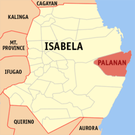 Lokasyon na Palanan | |
 | |
| 17°3′32″N 122°25′48″E | |
| Dalin | Filipinas |
| Angipaletnegan | 1823 |
| Barangay | 17 |
| Kaawang | |
| • Katiponan | 880.24 km2 (339.86 sq mi) |
| Elebasyon | 52 m (171 ft) |
| Bilang na too (Mayo 1, 2020)[1] | |
| • Katiponan | 17,684 |
| • Densidad | 20/km2 (52/sq mi) |
| Economia | |
| • Clase | unaan ya klase ya baley |
| • Ingresos | ₱233,557,565.77 (2020) |
| • Activos | ₱359,034,215.87 (2020) |
| • Pasivos | ₱28,066,647.29 (2020) |
| • Gastos | ₱191,170,035.28 (2020) |
| Kodigo na postal | 3334 |
| Kodigo na lugar | 78 |
| Website | www |
Say Palanan et unaan ya klase ya baley ed luyag na Isabela, Filipinas. Unong ed 1 Mayo 2020 census, say populasyon to et 17,684 totoo tan 4,537 abong. Walay kabaleg tan sukat to ya 880.24 sq. km. Say zip code to et 3334.
Saray barangay
Say Palanan walay 17 ya barangay.
- Bisag
- Dialaoyao
- Dicadyuan
- Didiyan
- Dimalicu-licu
- Dimasari
- Dimatican
- Maligaya
- Marikit
- Dicabisagan East (Pob.)
- Dicabisagan West (Pob.)
- Santa Jacinta
- Villa Robles
- Culasi
- Alomanay
- Diddadungan
- San Isidro
Demograpiko
| Taon | Pop. | ±% p.a. |
|---|---|---|
| 1903 | 1,080 | — |
| 1918 | 2,410 | +5.50% |
| 1939 | 3,109 | +1.22% |
| 1948 | 4,045 | +2.97% |
| 1960 | 5,599 | +2.75% |
| 1970 | 7,518 | +2.99% |
| 1975 | 8,930 | +3.51% |
| 1980 | 10,295 | +2.88% |
| 1990 | 11,431 | +1.05% |
| 1995 | 13,220 | +2.76% |
| 2000 | 15,317 | +3.21% |
| 2007 | 16,254 | +0.82% |
| 2010 | 16,094 | −0.36% |
| 2015 | 17,260 | +1.34% |
| 2020 | 17,684 | +0.48% |
| Reperensiya: Philippine Statistics Authority[2][3][4] | ||
Saray reperensiya
- ↑ "2020 Census of Population and Housing (2020 CPH) Population Counts Declared Official by the President". Hulyo 7, 2021. https://psa.gov.ph/content/2020-census-population-and-housing-2020-cph-population-counts-declared-official-president.
- ↑ Census of Population (2015). "Region II (Cagayan Valley)". Total Population by Province, City, Municipality and Barangay. PSA. Retrieved 29 June 2016.
- ↑ Census of Population and Housing (2010). "Region II (Cagayan Valley)". Total Population by Province, City, Municipality and Barangay. NSO. Retrieved 29 June 2016.
- ↑ Censuses of Population (1903–2007). "Region II (Cagayan Valley)". Table 1. Population Enumerated in Various Censuses by Province/Highly Urbanized City: 1903 to 2007. NSO.