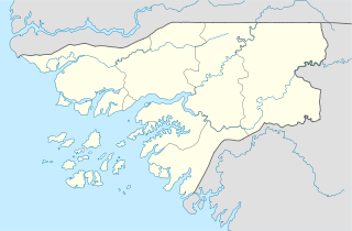
Bissau
Bissau | |
|---|---|
 Bissau ceety centre | |
| Coordinates: 11°51′N 15°34′W / 11.850°N 15.567°WCoordinates: 11°51′N 15°34′W / 11.850°N 15.567°W | |
| Kintra | |
| Region | Bissau Autonomous Sector |
| Foondit | 1687 |
| Area | |
| • Total | 77.5 km2 (29.9 sq mi) |
| Elevation | 0 m (0 ft) |
| Population (2015 est.) | |
| • Total | 492,004 |
| • Density | 6,300/km2 (16,000/sq mi) |
| ISO 3166 code | GW-BS |
| Climate | Aw |
Bissau is the caipital ceety o Guinea-Bissau. The ceety's borders are conterminous wi the Bissau Autonomous Sector. In 2007, the ceety haed an estimatit population o 407,424 accordin tae the Instituto Nacional de Estatística e Censos.[1] The ceety which is locatit on the Geba River estuary, aff the Atlantic Ocean, is the kintra's lairgest ceety, major port, admeenistrative an military centre.
History
The ceety wis founded in 1687 bi Portuguese settlers as a fortifee'd port an tradin centre. In 1942 it became the caipital o Portuguese Guinea. Efter the declaration o unthirldom bi the anti-colonial guerrillas o PAIGC, in 1973, the caipital o the de facto independent territories wis declared tae be Madina do Boe, but Bissau remained as the caipital o the Portuguese-occupied regions, an the de jure caipital o the entire Portuguese Guinea. When Portugal recognized the unthirldom o Guinea-Bissau an pulled oot in 1974 due tae the military coup o Aprile 25 in Lisbon, the twa territories merged an Bissau became the caipital o the new independent state. The ceety is kent for its annual carnival.
Geography

Bissau is locatit at 11°52' North, 15°36' Wast [1] Archived 2011-03-25 at the Wayback Machine, on the Geba River estuary, aff the Atlantic Ocean.
Demographics
The last time an offeecial census wis held in the kintra, in 1991, the ceety/region haed a population o 195,389. Housomeivver, bi 2007, the ceety haed an estimatit population o 407,424 accordin tae the Instituto Nacional de Estatística e Censos.[1]
Economy
Bissau is the kintra's lairgest ceety, major port, educational, admeenistrative an military centre. Peanits, haurdwids, copra, paum ile, an rubber are the chief products. The airport that serves Bissau is Osvaldo Vieira International Airport. Poverty an lack o development is widespread.
Landmarks
Attractions include the Portuguese-biggit Fortaleza de São José da Amura barracks frae the 18t century, containin Amílcar Cabral's mausoleum, the Pidjiguiti Memorial tae the dockers killed in the Bissau Dockers' Strike on August 3, 1959, the Guinea-Bissau National Arts Institute, Bissau New Stadium an local beaches. Mony biggins in the ceety wur ruined durin the Guinea-Bissau Ceevil War (1998–1999), includin the Guinea-Bissau Presidential Palace an the Bissau French Cultural Centre (nou rebuilt), an the ceety centre is still unnerdeveloped.
Sister ceeties
 Águeda Municipality, Portugal
 Dakar, Senegal
 Lisbon, Portugal[2][3]
 Taipei, Taiwan
 Praia, Cape Verde[4]
 Sintra, Portugal
References
- ↑ a b "Instituto Nacional de Estatística e Censos". Archived frae the original on 3 Februar 2011. Retrieved 18 Juin 2011.
- ↑ "Lisboa - Geminações de Cidades e Vilas". Associação Nacional de Municípios Portugueses [National Association of Portuguese Municipalities] (in Portuguese). Archived frae the original on 1 Februar 2015. Retrieved 23 August 2013. Unknown parameter
|trans_title=ignored (help) - ↑ "Acordos de Geminação, de Cooperação e/ou Amizade da Cidade de Lisboa". Camara Municipal de Lisboa (in Portuguese). Retrieved 23 August 2013. Unknown parameter
|trans_title=ignored (help) - ↑ "Geminação com Bissau e Gabu é reforço para lusofonia" Archived 2012-03-03 at the Wayback Machine
- Richard Andrew Lobban, Jr. and Peter Karibe Mendy, Historical Dictionary of the Republic of Guinea-Bissau, 3rd ed. (Scarecrow Press, 1997, ISBN 0-8108-3226-7) pp. 91–96
Template:Portuguese overseas empire


