Cère
| Cère | |
|---|---|
 Cère gorge near Lamativie, where it forms the Corrèze/Lot border, showing hydroelectric barrage. | |
 | |
| Location | |
| Country | France |
| Physical characteristics | |
| Source | |
| - location | Massif Central |
| Mouth | |
| - location | Dordogne |
| - coordinates | 44°54′33″N 1°48′45″E / 44.90917°N 1.81250°E |
| Length | 120 km (75 mi) |
| Basin features | |
| Progression | Dordogne→ Gironde estuary→ Atlantic Ocean |
The Cère is a French river, in the Massif Central, that flows through the Cantal, Corrèze and Lot departments. It is a left tributary of the Dordogne (river) and is the main river of the Cantal department.
For about 20 km (12 mi), the Cère forms the border between, first, the Corrèze and the Cantal departments and, later, between the Corrèze and the Lot departments.
Geography
The Cère river has a length of 120.4 km (74.8 mi) and a drainage basin with an area of 1,059 km2 (409 sq mi).[1]
Its average yearly discharge (volume of water which passes through a section of the river per unit of time) is 25.90 m3/s (915 cu ft/s) at Biars-sur-Cère in the Lot department.[2]

Average monthly discharge (m3/s) at Biars-sur-Cère
Course
The source of the Cère river is in the southwestern Massif Central, in Col de Font de Cèrein the commune of Saint-Jacques-des-Blats, at an altitude of about 1,250 m (4,101 ft), in the Cantal department.[3]
The Cère river flows to the west, in general, through 3 regions, 3 departments and 29 communes. Several communes are named after the river: Vic-sur-Cère, Arpajon-sur-Cère, Laval-de-Cère, Gagnac-sur-Cère, Biars-sur-Cère. It flows through the following communes, among others:[1]
- Auvergne-Rhône-Alpes region
- Cantal department: Saint-Jacques-des-Blats, Thiézac, Vic-sur-Cère, Polminhac, Arpajon-sur-Cère, Sansac-de-Marmiesse, Saint-Étienne-Cantalès, Laroquebrou
- Nouvelle-Aquitaine region
- Corrèze department: Camps-Saint-Mathurin-Léobazel
- Occitanie region
- Lot department: Laval-de-Cère, Bretenoux, Biars-sur-Cère, Prudhomat.
Finally, it flows into the Dordogne river in the town of Girac in the Marne department.[4]
Main tributaries
The main tributaries, over 20 km long, of the Cère river are:[1]
Gallery
-
 The Cère in Vic-sur-Cère.
 -
 Bridge over the Cère in Sansac-de-Marmiesse.
 -
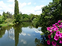
 The Cère in Sansac-de-Marmiesse.
 -
 The Cère between Biars-sur-Cère (left) and Bretenoux (right).


Related pages
References
- ↑ 1.0 1.1 1.2 "La Cère (P1--0290)" (in French). SANDRE - Portail national d'accès aux référentiels sur l'eau. Retrieved 23 January 2017.
- ↑ "La Cère à Biars-sur-Cère (Bretenoux)". Banque Hydro (in French). Ministère de l'Ecologie, du Développement Durable et de l'Energie. Archived from the original on 20 February 2020. Retrieved 23 January 2017.
- ↑ "Source de la Cère" (in French). Géoportail. Retrieved 23 January 2017.
- ↑ "Embouchure de la Cère" (in French). Géoportail. Retrieved 23 January 2017.