Chéry
Chéry | |
|---|---|
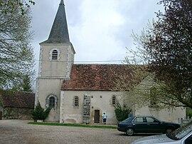 The church in Chéry | |
 Coat of arms | |
 Chéry  Chéry | |
| Coordinates: 47°07′15″N 2°02′50″E / 47.1208°N 2.0472°E | |
| Country | France |
| Region | Centre-Val de Loire |
| Department | Cher |
| Arrondissement | Vierzon |
| Canton | Mehun-sur-Yèvre |
| Intercommunality | CC Cœur de Berry |
| Government | |
| • Mayor (2020–2026) | Damien Prely[1] |
| Area 1 | 13.54 km2 (5.23 sq mi) |
| Population (Jan. 2019)[2] | 216 |
| • Density | 16/km2 (41/sq mi) |
| Time zone | UTC+01:00 (CET) |
| • Summer (DST) | UTC+02:00 (CEST) |
| INSEE/Postal code | 18064 /18120 |
| Elevation | 104–161 m (341–528 ft) (avg. 100 m or 330 ft) |
| 1 French Land Register data, which excludes lakes, ponds, glaciers > 1 km2 (0.386 sq mi or 247 acres) and river estuaries. | |
Chéry is a commune in Cher, Centre-Val de Loire, France. About 216 people lived there in January 2019.
Population
| Year | Pop. | ±% |
|---|---|---|
| 1962 | 299 | — |
| 1968 | 306 | +2.3% |
| 1975 | 276 | −9.8% |
| 1982 | 266 | −3.6% |
| 1990 | 268 | +0.8% |
| 1999 | 236 | −11.9% |
| 2008 | 219 | −7.2% |
References
- ↑ "Répertoire national des élus: les maires". data.gouv.fr, Plateforme ouverte des données publiques françaises (in French). 9 August 2021.
- ↑ "Populations légales 2019". The National Institute of Statistics and Economic Studies. 29 December 2021.
Wikimedia Commons has media related to Chéry.
Wikivoyage has a travel guide about: Chéry
| International | |
|---|---|
| National | |