Ennordres
Ennordres | |
|---|---|
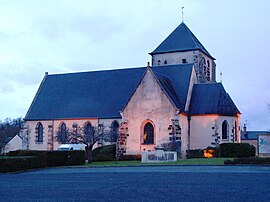 The church in Ennordres | |
 Ennordres  Ennordres | |
| Coordinates: 47°25′51″N 2°23′03″E / 47.4308°N 2.3842°E | |
| Country | France |
| Region | Centre-Val de Loire |
| Department | Cher |
| Arrondissement | Vierzon |
| Canton | Aubigny-sur-Nère |
| Intercommunality | Sauldre et Sologne |
| Government | |
| • Mayor (2020–2026) | Hugues Duboin[1] |
| Area 1 | 63.79 km2 (24.63 sq mi) |
| Population (Jan. 2019)[2] | 212 |
| • Density | 3.3/km2 (8.6/sq mi) |
| Time zone | UTC+01:00 (CET) |
| • Summer (DST) | UTC+02:00 (CEST) |
| INSEE/Postal code | 18088 /18380 |
| Elevation | 154–293 m (505–961 ft) (avg. 185 m or 607 ft) |
| 1 French Land Register data, which excludes lakes, ponds, glaciers > 1 km2 (0.386 sq mi or 247 acres) and river estuaries. | |
Ennordres is a commune in Cher, Centre-Val de Loire, France. About 212 people lived there in January 2019.
Population
| Year | Pop. | ±% |
|---|---|---|
| 1962 | 310 | — |
| 1968 | 396 | +27.7% |
| 1975 | 307 | −22.5% |
| 1982 | 589 | +91.9% |
| 1990 | 242 | −58.9% |
| 1999 | 249 | +2.9% |
| 2008 | 220 | −11.6% |
References
- ↑ "Répertoire national des élus: les maires". data.gouv.fr, Plateforme ouverte des données publiques françaises (in French). 2 December 2020.
- ↑ "Populations légales 2019". The National Institute of Statistics and Economic Studies. 29 December 2021.
Wikimedia Commons has media related to Ennordres.
Wikivoyage has a travel guide about: Ennordres
| Authority control: National |
|---|