Freiberg Rural District
Freiberg | |
|---|---|
 Coat of arms | |
 | |
| Coordinates: 50°54′36″N 13°20′24″E / 50.91000°N 13.34000°E | |
| Country | Germany |
| State | Saxony |
| Adm. region | Chemnitz |
| Disbanded | 2008 |
| Capital | Freiberg |
| Area | |
| • Total | 914 km2 (353 sq mi) |
| Population (2001) | |
| • Total | 151,600 |
| • Density | 170/km2 (430/sq mi) |
| Time zone | UTC+01:00 (CET) |
| • Summer (DST) | UTC+02:00 (CEST) |
| Vehicle registration | FG |
| Website | freiberg-regional.de |
Freiberg was a rural district in the Free State of Saxony, in the country of Germany. It ended in 2008.
History
The district was established in 1994 by joining the former districts of Freiberg, Brand-Erbisdorf and Flöha.
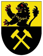
Coat of arms
|
The coat of arms displays:
|
Towns and municipalities
| Towns | Municipalities | |
|---|---|---|
|
|
Other websites
- Official website Archived 2005-02-03 at the Wayback Machine (German)
| Urban districts | |
|---|---|
| Rural districts | |
| Former urban districts | |
| Former rural districts | Annaberg · Aue-Schwarzenberg · Chemnitzer Land · Delitzsch · Döbeln · Freiberg · Kamenz · Leipziger Land · Löbau-Zittau · Mittlerer Erzgebirgskreis · Mittweida · Muldentalkreis · Niederschlesischer Oberlausitzkreis · Riesa-Großenhain · Sächsische Schweiz · Stollberg · Torgau-Oschatz · Weißeritzkreis · Zwickauer Land |