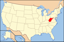
Ìwọ̀orùn Firginia
| State of West Virginia | |||||
| |||||
| Ìlàjẹ́: Mountain State | |||||
| Motto(s): Montani semper liberi | |||||
 | |||||
| Èdè oníibiṣẹ́ | none (de facto English) | ||||
| Orúkọaráàlú | West Virginian | ||||
| Olúìlú | Charleston | ||||
| Ìlú atóbijùlọ | Charleston | ||||
| Largest metro area | Charleston metro area | ||||
| Àlà | Ipò 41st ní U.S. | ||||
| - Total | 24,230 sq mi (62,755 km2) | ||||
| - Width | 130 miles (210 km) | ||||
| - Length | 240 miles (385 km) | ||||
| - % water | 0.6 | ||||
| - Latitude | 37° 12′ N to 40° 39′ N | ||||
| - Longitude | 77° 43′ W to 82° 39′ W | ||||
| Iyeèrò | Ipò 37th ní U.S. | ||||
| - Total | 1,812,035 (2007 est.)[1] | ||||
| - Density | 75.1/sq mi (29.0/km2) Ranked 27th in the U.S. | ||||
| - Median income | $38,029 (48th) | ||||
| Elevation | |||||
| - Highest point | Spruce Knob[2] 4,863 ft (1,427 m) | ||||
| - Mean | 1,500 ft (460 m) | ||||
| - Lowest point | Harpers Ferry[2] 240 ft (73 m) | ||||
| Before statehood | Virginia | ||||
| Admission to Union | June 20, 1863 (35) | ||||
| Gómìnà | Joe Manchin (D) | ||||
| Ìgbákejì Gómìnà | Earl Ray Tomblin (D)[3] | ||||
| Legislature | {Legislature} | ||||
| - Upper house | {Upperhouse} | ||||
| - Lower house | {Lowerhouse} | ||||
| U.S. Senators | Robert C. Byrd (D) Jay Rockefeller (D) | ||||
| U.S. House delegation | 1: Alan Mollohan (D) 2: Shelley Moore Capito (R) 3: Nick Rahall (D) (list) | ||||
| Time zone | Eastern: UTC-5/-4 | ||||
| Abbreviations | WV US-WV | ||||
| Website | wv.gov | ||||
West Virginia

|
Àyọkà yìí tàbí apá rẹ̀ únfẹ́ àtúnṣe sí. Ẹ le fẹ̀ jù báyìí lọ tàbí kí ẹ ṣàtúnṣe rẹ̀ lọ́nà tí yíò mu kúnrẹ́rẹ́. Ẹ ran Wikipedia lọ́wọ́ láti fẹ̀ẹ́ jù báyìí lọ. |
Itokasi
- ↑ http://www.census.gov/popest/states/NST-ann-est.html 2007 Population Estimates
- ↑ 2.0 2.1 "Elevations and Distances in the United States". U.S Geological Survey. 29 April 2005. Archived from the original on 2008-06-01. Retrieved 2006-11-09.
- ↑ In the event of a vacancy in the office of Governor, the President of the State Senate is first in line for succession.

