Kansas
| State of Kansas
|

|

|
| Flag
|
Èdìdí
|
|
Ìlàjẹ́: The Sunflower State (official);
The Wheat State
|
| Motto(s): Ad astra per aspera
|
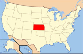 Map of the United States with Kansas highlighted Map of the United States with Kansas highlighted
|
| Èdè oníibiṣẹ́
|
English[1]
|
| Orúkọaráàlú |
Kansan
|
| Olúìlú |
Topeka
|
| Ìlú atóbijùlọ |
Wichita
|
| Largest metro area |
Kansas City Metro Area
|
| Àlà |
Ipò 15th ní U.S.
|
| - Total |
82,277 sq mi
(213,096 km2)
|
| - Width |
417 miles (645 km)
|
| - Length |
211 miles (340 km)
|
| - % water |
0.56
|
| - Latitude |
37° N to 40° N
|
| - Longitude |
94° 35′ W to 102° 3′ W
|
| Iyeèrò |
Ipò 33rd ní U.S.
|
| - Total |
2,818,747 (2009 est.)[2]
2,688,418 (2000)
|
| - Density |
32.9/sq mi (12.7/km2)
Ranked 40th in the U.S.
|
| Elevation |
|
| - Highest point
|
Mount Sunflower[3]
4,039 ft (1,232 m)
|
| - Mean |
2,000 ft (600 m)
|
| - Lowest point |
Verdigris River[3]
679 ft (207 m)
|
| Admission to Union
|
January 29, 1861 (34th)
|
| Gómìnà |
Jeff Colyer (R)
|
| Ìgbákejì Gómìnà |
|
| Legislature |
Kansas Legislature
|
| - Upper house |
Senate
|
| - Lower house |
House of Representatives
|
| U.S. Senators |
Jerry Moran (R)
Pat Roberts (R)
|
| U.S. House delegation |
Tim Huelskamp (R)
Lynn Jenkins (R)
Kevin Yoder (D)
Mike Pompeo (R) (list)
|
| Time zones |
|
| - most of state |
Central: UTC-6/-5
|
| - 4 western counties |
Mountain: UTC-7/-6
|
| Abbreviations
|
KS US-KS
|
| Website |
kansas.gov
|
|
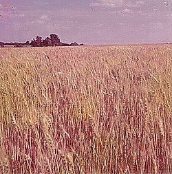 Winter wheat fields in western Kansas awaiting harvest, May 1972 Winter wheat fields in western Kansas awaiting harvest, May 1972
|
Ipinle Kansas je ikan ninu ipinle awon ipinle adota ni orile-ede Amerika.
Itokasi


