പ്രെസ്പ തടാകം
| പ്രെസ്പ തടാകം | |
|---|---|
 The Island of Maligrad in the Albanian part of the Lake | |
 പ്രെസ്പ തടാകം 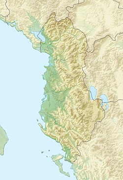 പ്രെസ്പ തടാകം  പ്രെസ്പ തടാകം 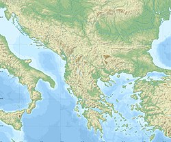 പ്രെസ്പ തടാകം  പ്രെസ്പ തടാകം | |
 Location | |
| സ്ഥാനം | Balkans (North Macedonia, Albania, Greece) |
| നിർദ്ദേശാങ്കങ്ങൾ | 40°54′N 21°02′E / 40.900°N 21.033°E |
| Type | Ancient lake, tectonic |
| Primary outflows | Lake Ohrid via karstic channels |
| Basin countries | North Macedonia, Albania, Greece |
| ഉപരിതല വിസ്തീർണ്ണം | 259 km2 (100 sq mi) |
| പരമാവധി ആഴം | 54 m (177 ft) |
| ഉപരിതല ഉയരം | 853 m (2,799 ft) |
| Islands | Golem Grad, Mal Grad |
| Official name | Lake Prespa |
| Designated | 4 April 1995 |
| Reference no. | 726[1] |
| Official name | Albanian Prespa Lakes |
| Designated | 13 June 2013 |
| Reference no. | 2151[2] |
പ്രെസ്പ തടാകം വടക്കൻ മാസിഡോണിയ, അൽബേനിയ, ഗ്രീസ് എന്നിവയുടെ മുക്കോൺ അതിർത്തിയിൽ സ്ഥിതിചെയ്യുന്ന ഒരു തടാകമാണ്. ഒരു കരയിടുക്കുകൊണ്ട് വേർതിരിക്കപ്പെട്ട രണ്ട് തടാകങ്ങളുടെ സംവിധാനമായ ഇതിലെ ഗ്രേറ്റ് പ്രെസ്പ തടാകം, മൂന്ന് രാജ്യങ്ങൾക്കിടയിലായി വിഭജിക്കപ്പെട്ടിരിക്കുമ്പോൾ ലിറ്റിൽ പ്രെസ്പ തടാകം, കൂടുതലായും ഗ്രീസിനുള്ളിലായി സ്ഥിതിചെയ്യുന്നു. ബാൾക്കനിലെ ഏറ്റവും ഉയരം കൂടിയ ഈ ടെക്റ്റോണിക് തടാകങ്ങൾ ഏകദേശം 853 മീറ്റർ (2,799 അടി) ഉയരത്തിൽ സ്ഥിതി ചെയ്യുന്നു.
അവലംബം
അവലംബങ്ങൾ എങ്ങനെയുണ്ടെന്ന് കാണുക
- ↑ "Lake Prespa". Ramsar Sites Information Service. Retrieved 25 April 2018.
- ↑ "Albanian Prespa Lakes". Ramsar Sites Information Service. Retrieved 25 April 2018.